Gaia GPS: The Best App for Landscape Photographers
Why All Landscape Photographers Should Have The Gaia GPS App
As an avid outdoorsman and landscape photographer, I use several smartphone apps to help with scouting locations, planning shots, tracking routes and recording data. Many of these are designed specifically for photographers, such as The Photographer’s Ephemeris, Photopills and Adobe Lightroom CC. I find all of these to be useful, but one app stands above the rest in my collection: Gaia GPS. Not only is Gaia my favorite app for landscape photography, but also my favorite smartphone app in general. What make this app so useful? Read on to find out more.
Overview of Gaia GPS & Gaia Maps
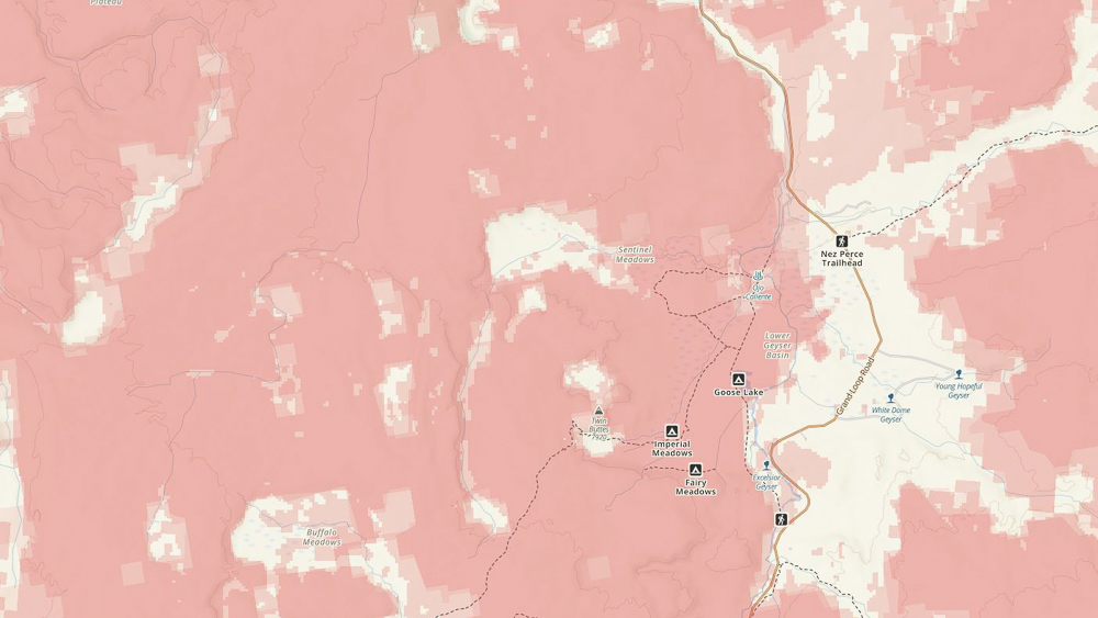
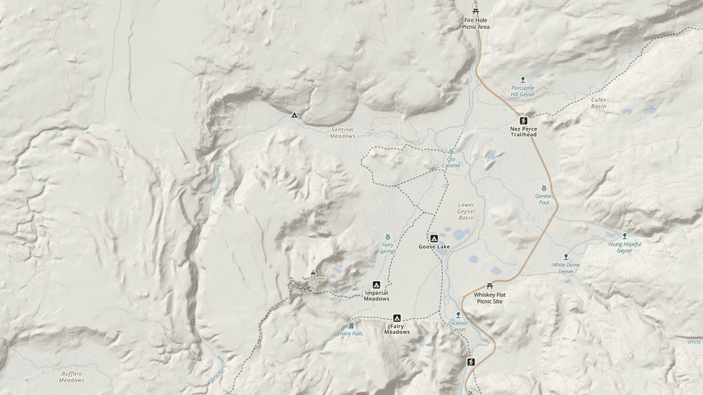
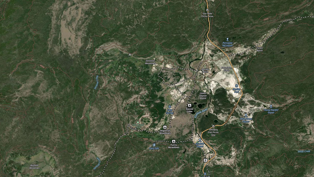
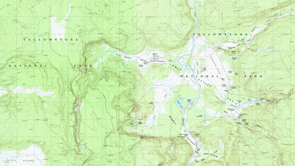
Gaia GPS is a mapping and GPS navigation application for mobile devices as well as desktop browsers. With numerous maps types, an offline mode, full GPS functionality and a suite of recording options, Gaia is a full featured navigation application. After signing up for free, users have access to the standard Gaia Topo map that covers the entire world and can be used when in cell service range. The Gaia Topo was recently revised and is a beautiful, well designed map. Based on OpenStreetMap, it has an extensive list of place names, trails, water sources, roads and points of interest. With a modern look and feel, this is my go-to map for research, planning routes and recording tracks.
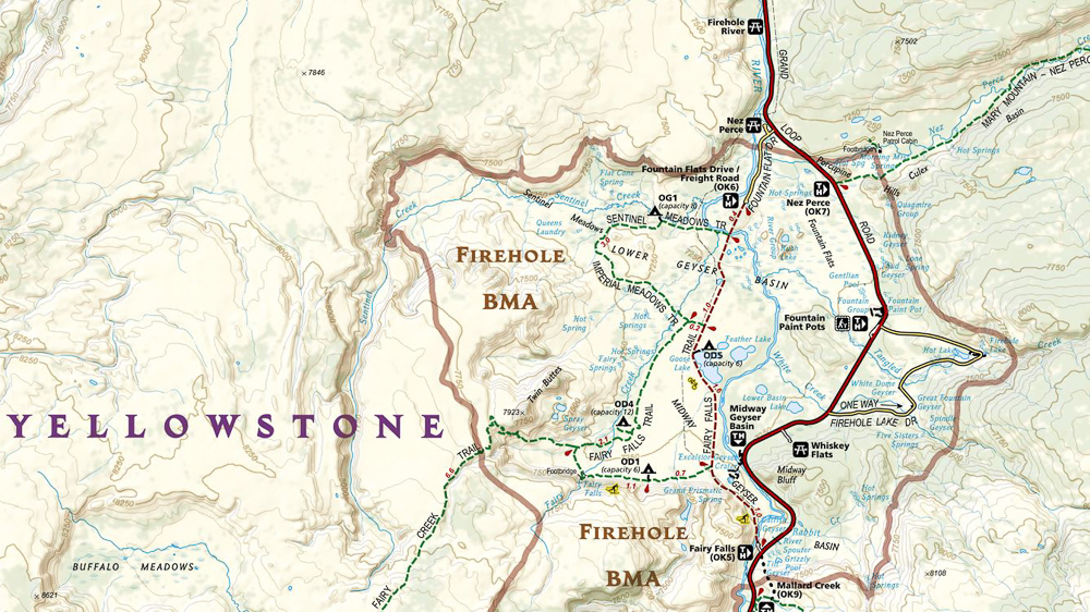
The free level of Gaia works well for front-country trips that are within cell service range. However, if you plan on using the app in the backcountry you will need to upgrade to one of the premium levels. There are three levels of usage: Free, Membership and Premium. When I started using Gaia, I signed up and used the free level to get a feel for the app and features. Within a few days I realized that the functionality was perfect for my needs and upgraded to the Premium level so I could access all the features and maps. Most notably, the Premium level gets you access to the entire map library, including the National Geographic Trails Illustrated. The NatGeo maps are well known to outdoor enthusiasts and have been a reliable navigational aid for years. To have these included in app form is a huge benefit, and a great reason to upgrade to the premium level. For reference, each map in paper form is $14.95 so accessing them all in digital form for $36.00 per year is a fantastic deal.
Primary Functions of Gaia GPS:
Trip Planning
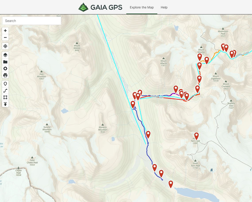
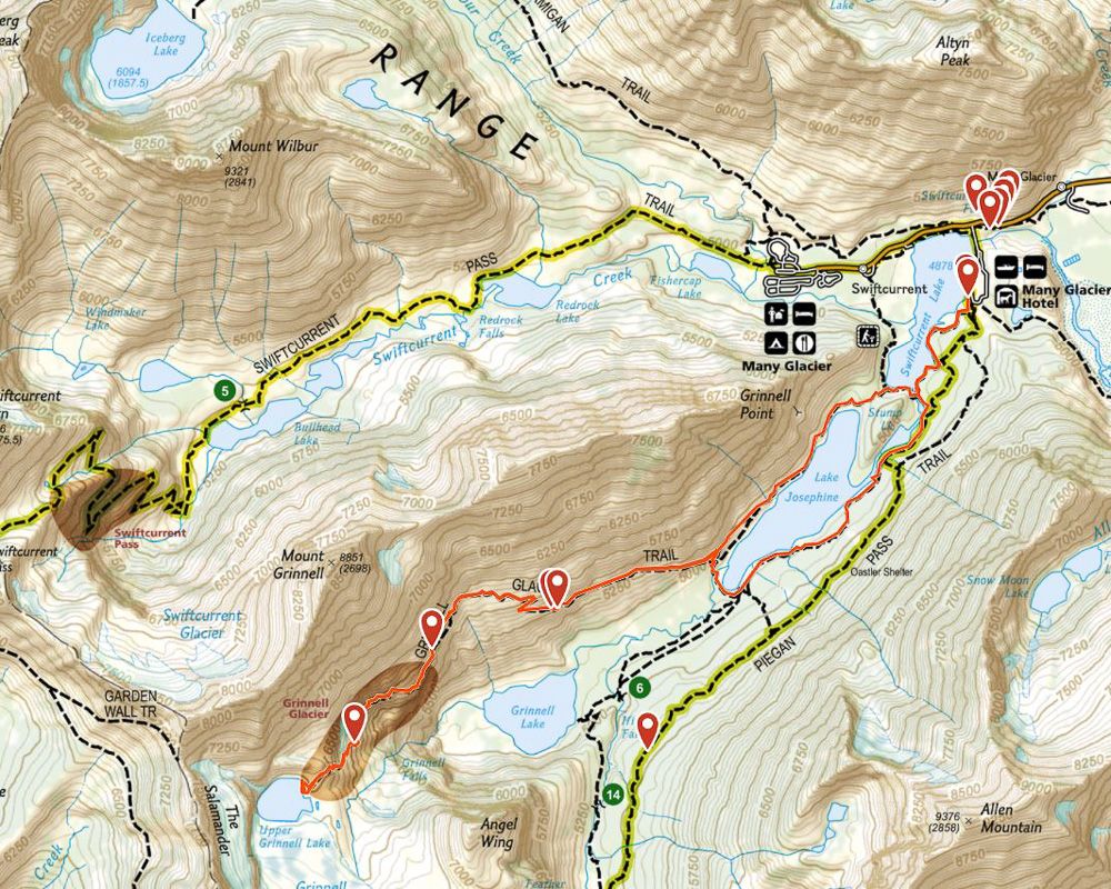
As noted, Gaia GPS is a navigation app to be used in planning, recording and route finding. For planning purposes, users can select a map type (multiple maps can also be combined into layers with varying levels of opacity) that suits their needs. For basic topographical maps, the Gaia Topo is great, but there are several others to choose from including USFS and NeoTreks. Other map types will be covered below. Once a map is visible, users can rotate and zoom to their desired location. If a trail is marked on the map, route planning is very straightforward. Simply click the Create Route button on the map, click on your starting point, mid points and ending points. With the trail visible, Gaia will snap the route to the trail outline automatically. Once completed, name the route and Gaia will show you the exact mileage and elevation change for the route. If you want to plan a trip you can use Gaia to select your map type, plan all routes (on trail or off trail), add waypoints and areas, save the map to your mobile device for offline usage and print the visible portion of the map. If you have maps and waypoints saved on a handheld GPS, Google Maps or other mapping software, Gaia allows users to import .GPX, .KML, .KMZ, .FIT and .GEOJSON file types.
Location Recording
Prior to leaving cell service, users will want to download the map area that covers their intended destinations. This is done by zooming to a level that shows all the areas you will cover, clicking the “+” symbol and selecting Download Maps. You can select your zoom level and save the map to your device. Now you can access that map anytime, even outside of cell service. Once you have embarked on a trip, Gaia turns your mobile device into a powerful and user-friendly GPS device. In the backcountry I always bring a Garmin InReach handheld GPS to ensure I have a way to communicate with friends and family, and to send an SOS in case of an emergency. However, I only use the InReach for communication purposes. For navigation and recording, Gaia GPS is my go-to (as well as a paper map as a backup). For hiking trips, I open the app each day to initiate recording, and then put the device in my pocket or bag. The GPS signal connects to satellites quickly and has no trouble recording when in a pocket or backpack. If the screen is off, recording tracks does not drain batteries to any significant degree (in my experience). I have gone two days without charging my phone with 8+ hours of recording each day and still had battery life left over. While recording, Gaia shows you several statistics including:
- Distance
- Average speed
- Average moving speed
- Ascent
- Max and min elevations
- Current elevation
- Sunrise/Sunset Times
Route Finding
For unmarked trails, hard to follow trails or off trail bushwhacking, Gaia is enormously helpful. By opening the app, centering on your position and then using the Course Mode (click the crosshairs to center, and then click the crosshairs again to turn on Course Mode), you can easily see what direction you are facing, where your route is, etc. by pointing the phone in different directions. This is no substitute for basic navigation skills with a map and compass, but it can be a quick and easy aid for finding your way.
Gaia GPS Map Library
The Gaia map library is always expanding. As good as the Gaia Topo is, there are times you want specialized maps to help plan a trip or find useful information. Some of the most useful and unique maps are below (this list is not exhaustive):
- Air Quality (Current and Tomorrow)
- Avalanche Forecast
- Cell Coverage
- Gaia Topo
- Light Pollution
- National Geographic Trails Illustrated
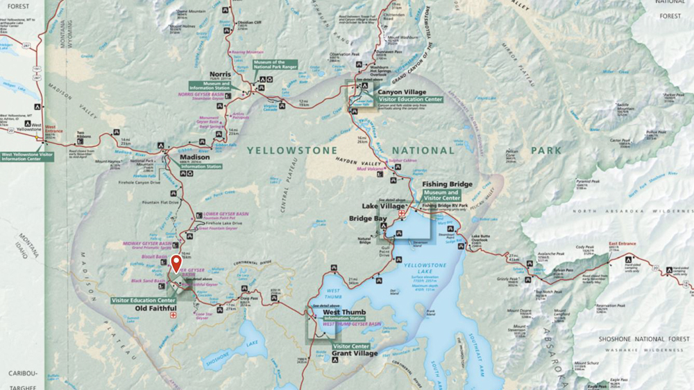
- National Park Service Visitor Maps
- Precipitation Forecast
- Satellite Topo
- Shaded Relief
- USGS Topo
- Wildfires
Using Gaia GPS for Landscape Photography
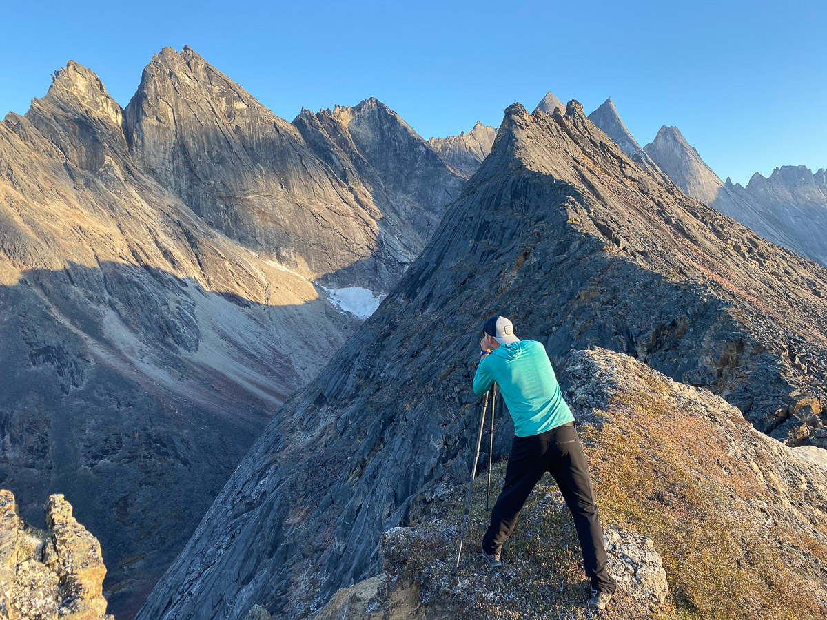
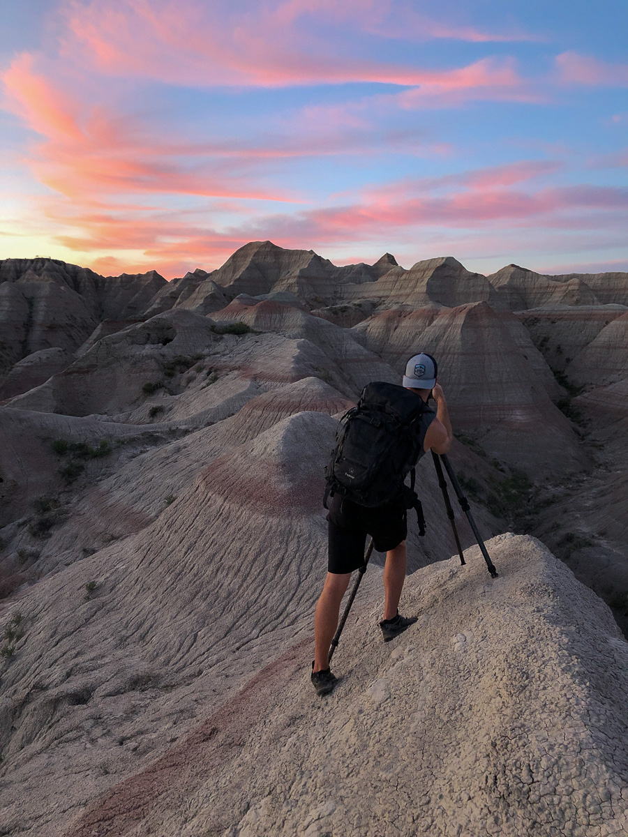
As a landscape photographer, I am always on the lookout for new places and new compositions. In 2018 my wife and I traveled over 50,000 miles around the USA in our RV, photographing along the way. I have a good memory, but I certainly can’t remember all the areas I photographed and the exact spots for compositions! With Gaia, my favorite feature is the adding a photo with GPS data attached. You can do this while recording a route, or just by opening the app, clicking the photo icon, taking a photo and saving it. This adds a pinned waypoint to the exact spot the photo was taken, which is an amazing tool for photographers. I use this in many ways, but more than anything I find it indispensable in areas that have a lot of open expanse with similar land features.
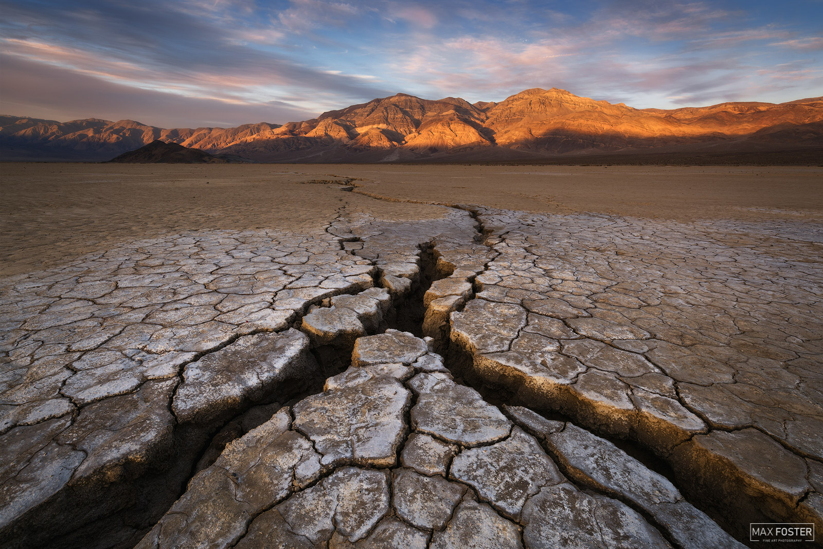
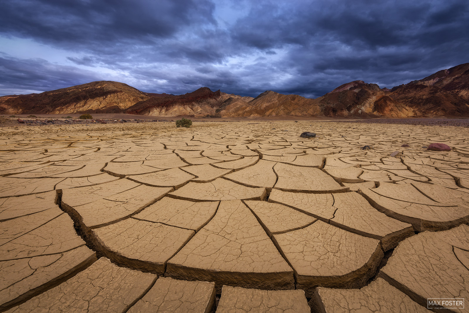
For example, Death Valley's Badwater Basin is an enormous open area with over 38 square miles of salt flats. It may take hours to find the perfect composition of salt polygons or dried mud tiles, and without a GPS waypoint you may never find that spot again. Additionally, you may find several compositions you like, but want to review later to pick the perfect one for a subsequent photo shoot. Gaia allows you to review each photo and after selecting your favorite composition, navigate right to the exact spot. This is perhaps my favorite feature of the app and it is extremely accurate. Another use for this feature is taking photos with GPS coordinates along a hike to incorporate into a trip report. Using routes and prerecorded tracks to estimate hike time is another useful feature for photographers. It is crucial to arrive at your location on time for the light you want, and Gaia can give you the data you need to make an informed decision.
Take Gaia GPS With You Everywhere
Gaia GPS is indispensable for adventurers and landscape photographers alike. With a huge library of maps for a wide variety of uses, Gaia can help plan your next trip and record everything along the way. Combined with the large storage capacities and long battery life of modern mobile devices, I believe Gaia is much more user friendly and useful for navigational purposes than handheld GPS devices. With the exception of satellite text and voice communication capabilities, I use Gaia GPS for all my outdoor navigation needs and highly recommend it for all outdoor enthusiasts. If you are interested in purchasing a Gaia GPS Membership be sure to use this link when signing up to get 20% off the regular price!
This post contains affiliate links. If you use these links to buy something, I may earn a small commission at no additional cost to you. Thanks!